What types of SDGs can be addressed with geospatial analytics?
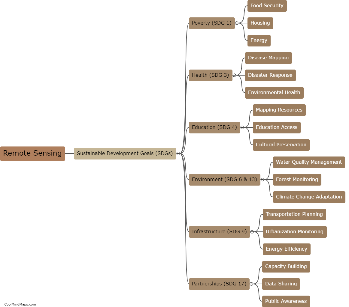
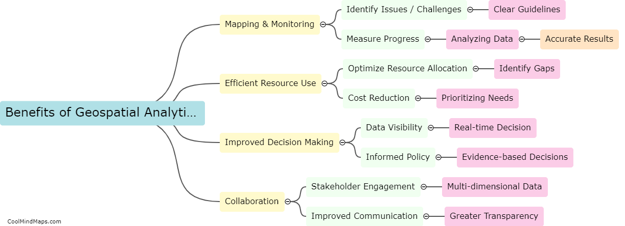
Geospatial analytics can effectively tackle a wide range of Sustainable Development Goals (SDGs), especially those related to social, economic, and environmental issues. For example, geospatial analysis can be used to monitor and track poverty, access to education, healthcare, food security, climate change, and natural disasters. Geospatial data can also help policymakers make informed decisions by identifying areas that are in need of development, and where resources should be allocated to achieve SDGs. Furthermore, geospatial analytics can be used to evaluate the effectiveness and impact of development projects, as well as to measure progress towards achieving SDGs.

This mind map was published on 21 May 2023 and has been viewed 124 times.