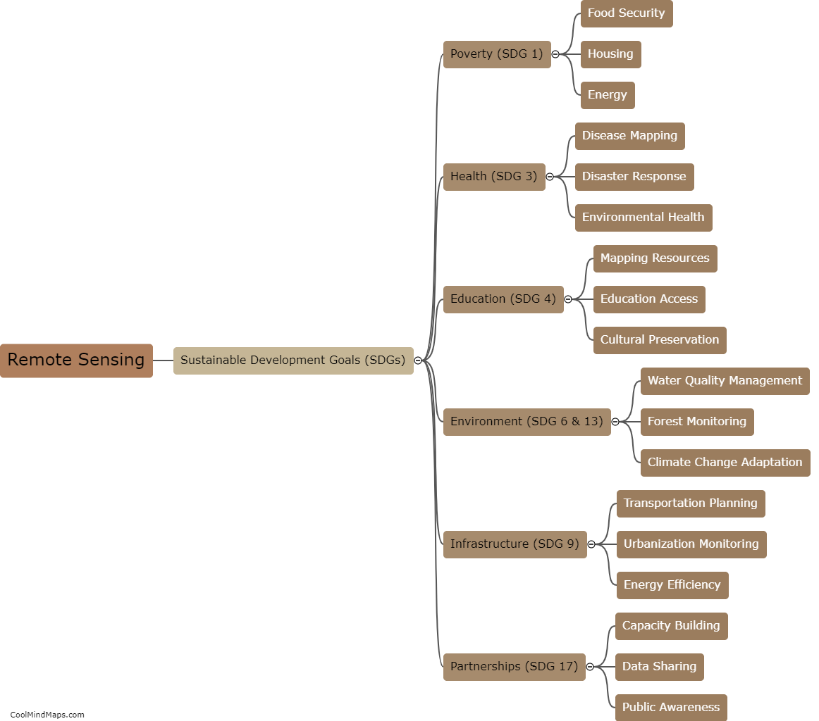
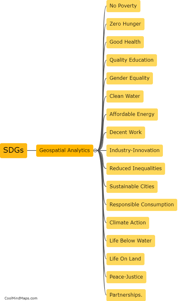
What are the benefits of using geospatial analytics in achieving SDGs?
Geospatial analytics refers to the use of location-based data to gain insights and make informed decisions. When applied to achieving the UN's Sustainable Development Goals (SDGs), geospatial analytics can provide numerous benefits. For instance, it can help organizations determine the areas and populations most in need of assistance, identify patterns and trends in social and environmental data, monitor progress towards SDG targets, and track the effectiveness of interventions. By harnessing the power of location intelligence, geospatial analytics can help accelerate progress towards achieving the SDGs and create a more sustainable future for all.

This mind map was published on 19 May 2023 and has been viewed 103 times.