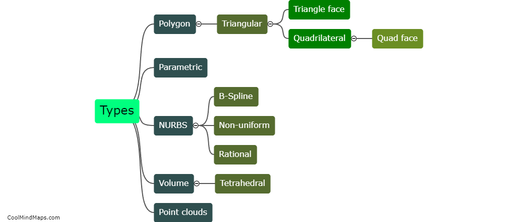
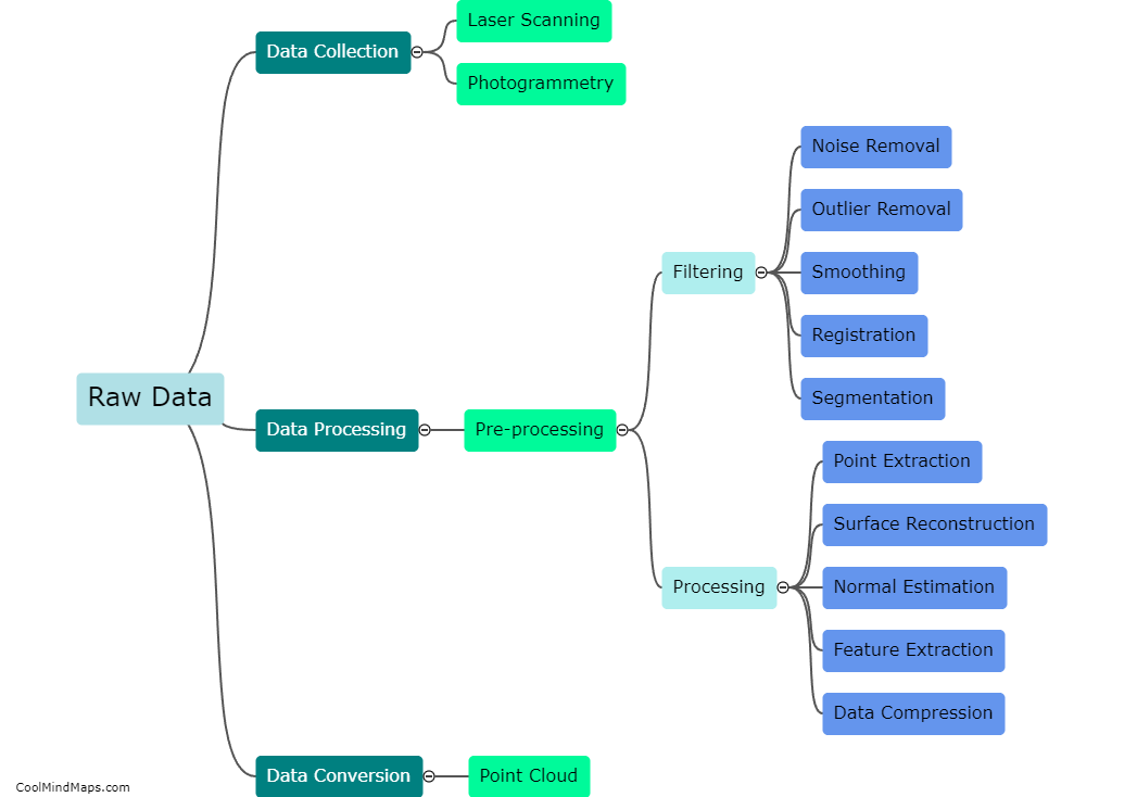
How is 3D point cloud data used in meshing?
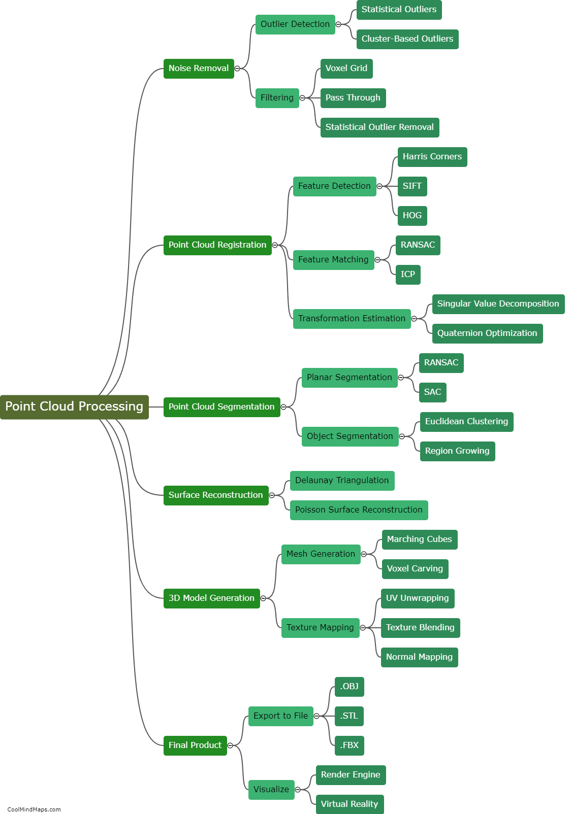
In meshing, 3D point cloud data is used to create a mesh representation of a physical object or environment. Point cloud data is typically obtained through the use of 3D scanning technologies or lidar systems that capture the spatial coordinates of multiple points in a three-dimensional space. This data is then processed and used to generate a mesh, which is a three-dimensional representation composed of interconnected vertices, edges, and faces. The point cloud data serves as the foundational information for determining the location and density of these vertices, which form the surface of the mesh. By utilizing the point cloud data, meshing algorithms can accurately recreate the geometry or topography of an object or terrain, enabling further analysis, visualization, or simulation of the scanned environment.

This mind map was published on 19 November 2023 and has been viewed 77 times.