Definition of GIS
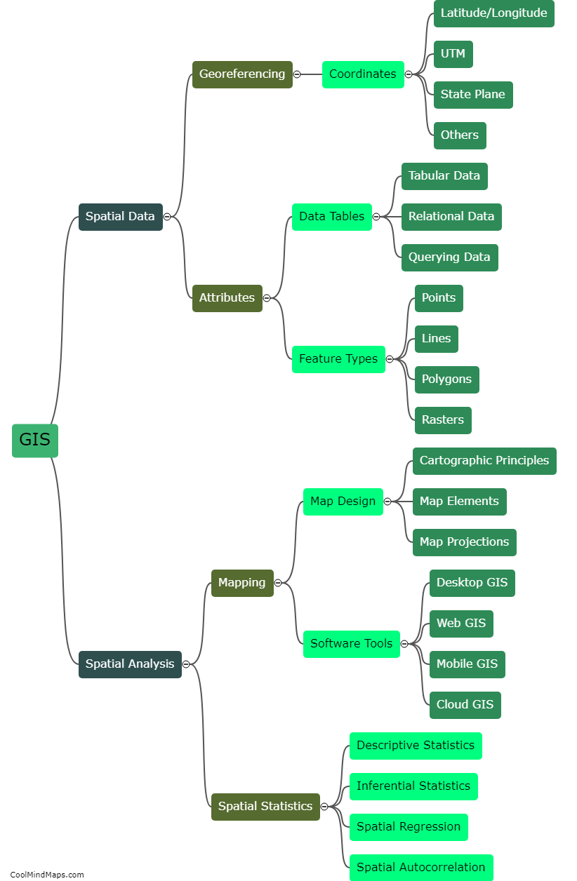
GIS stands for Geographic Information System. It is a computer-based system that collects, stores, analyzes, and presents geographic or spatial data. GIS integrates hardware, software, data, and human resources to enable researchers, scientists, planners, and managers to better understand and interpret the spatial patterns and relationships of various phenomena. GIS technology can be used to support a wide range of applications from urban planning, natural resource management, and emergency response planning to public health research, climate change analysis, and marketing research. Essentially, GIS allows users to visualize, analyze, and model complex spatial data, produce maps, and make informed decisions based on their findings.
This mind map was published on 18 May 2023 and has been viewed 130 times.
