What are the benefits of using GIS in pest prediction?
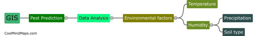
GIS, or geographic information system, can provide several benefits in predicting and managing pests. One of the major advantages is the ability to integrate data from various sources such as satellite imagery, data from weather stations, and soil data, to create a comprehensive map of pest distribution and prevalence. GIS can also help in identifying vulnerable areas and possible pathways for pest infestations. This information can be used to develop effective pest management strategies such as targeted and timely interventions, reducing the negative impact of pests on crops, animals, and the environment. Overall, GIS can provide crucial information for decision-making related to pest management, leading to reduced losses and increased productivity.

This mind map was published on 28 May 2023 and has been viewed 110 times.