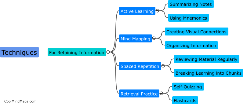
How does GIS help with pest prediction?
GIS (Geographic Information Systems) have proved helpful in predicting and controlling pests. GIS software allows experts to map out the distribution of various pests, identifying patterns and hotspots. By analyzing the data, GIS can help predict areas that may be more prone to pest infestations, based on factors such as climate, soil, and vegetation cover. GIS can also assist in monitoring pest populations over time, enabling experts to identify trends in order to make data-driven decisions about pest control measures. This helps to reduce the environmental impact of pesticides and allows for targeted interventions that are more effective in controlling pests.

This mind map was published on 28 May 2023 and has been viewed 93 times.