What are the applications of GIS?
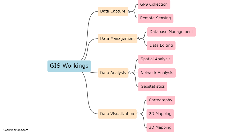
Geographic Information Systems (GIS) has become an essential tool in many different fields, including urban planning, natural resource management, environmental monitoring, disaster response and management, and public health. GIS can be used to create detailed maps, analyze complex geographic patterns and relationships, identify trends and predict future changes, and perform spatial analyses to inform decision-making. Some of the applications of GIS include mapping land use and zoning, identifying potential hazards and risks, monitoring air and water quality, managing transportation systems, and providing assistance during emergency situations. Overall, GIS has a wide range of applications that make it an invaluable tool for professionals in various fields.

This mind map was published on 18 May 2023 and has been viewed 109 times.