How is GIS used in environmental management?
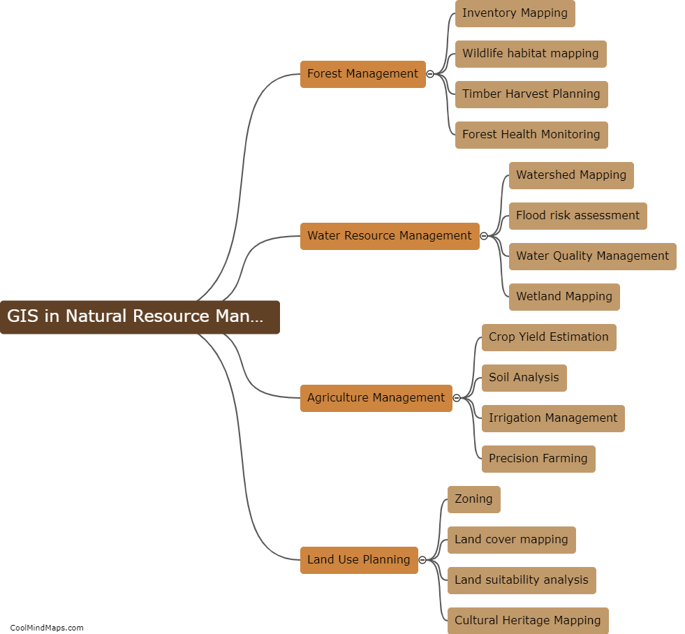
GIS (Geographic Information System) is a valuable tool in environmental management as it allows experts to analyze and map various environmental data with location-specific information. It helps in identifying environmental hazards, tracking water quality, mapping protected areas, and monitoring the distribution of hazardous materials. With GIS, managers can make informed decisions on land-use planning, wildlife conservation, and environmental policy making, ensuring that natural resources are protected and managed sustainably. It also enables the integration of environmental data with social and economic information, allowing stakeholders to understand the impact of environmental issues on communities. Overall, GIS facilitates a comprehensive and strategic approach to environmental management.

This mind map was published on 22 May 2023 and has been viewed 136 times.