What are the applications of geospatial analysis?
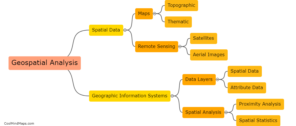
Geospatial analysis is a set of techniques and tools used to transform geospatial data into valuable insights and information. These insights can be applied to a range of industries, including transportation, urban planning, health, agriculture, and environmental management. For instance, geospatial analysis can be used to identify traffic patterns and optimize transportation routes, map urban land use patterns and plan for city growth and development, track the spread of infectious diseases and analyze their causes, aid in precision agriculture, and assess the impact of natural disasters and climate change on the environment. In sum, geospatial analysis is a powerful tool for understanding and addressing complex spatial problems.

This mind map was published on 19 May 2023 and has been viewed 110 times.